
The Post Mills Montague Dam removal project
Ron Rhodes said that the schedule for the project is not yet fixed. It could possibly start this year, but could also be postponed till 2022.
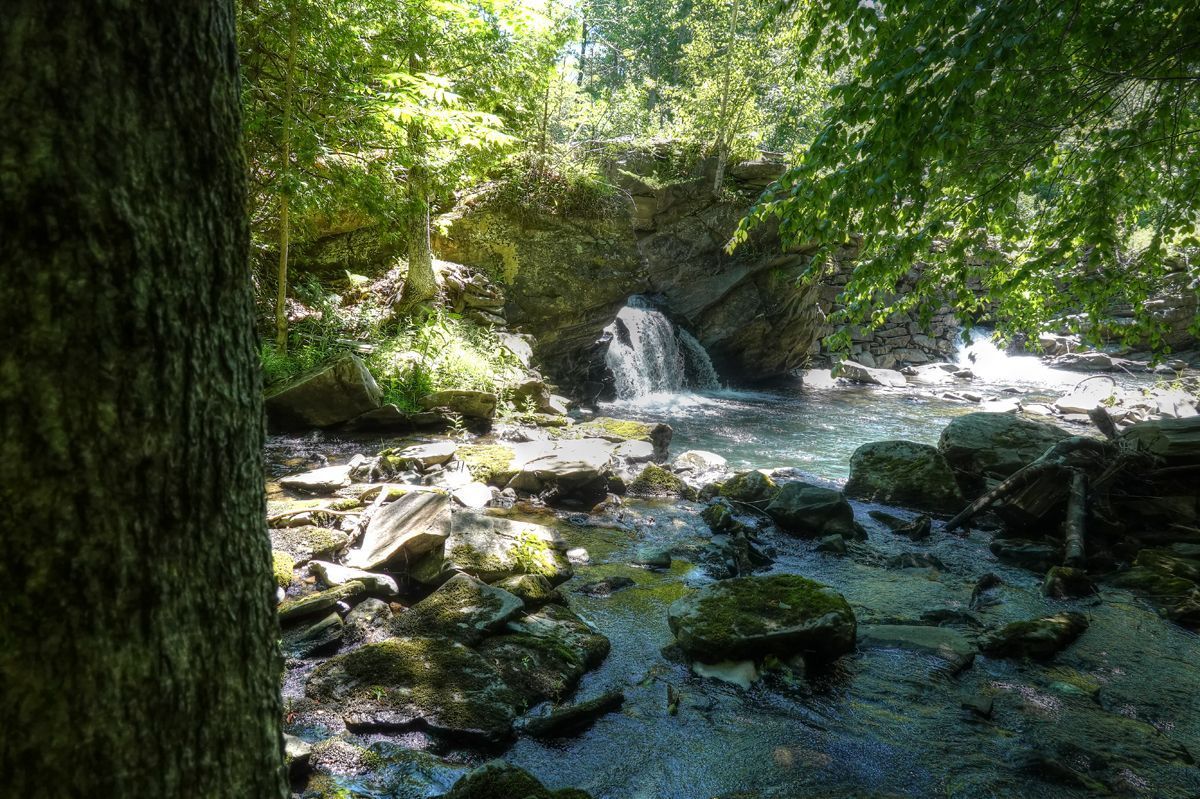
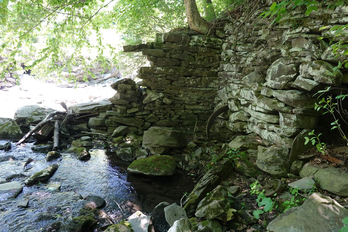
Just upstream of the bridge where Route 113 crosses the Ompompanoosuc River in Post Mills, one might glimpse a stone structure, hidden by trees and tall weeds most of the year. These are the remains of the Montague Rod and Reel dam, a vestige of a once-bustling factory that was the largest manufacturer of fishing rods in the country until it closed in 1933 due to the Great Depression. The dam maintained a mill pond upstream of the factory, ensuring a continuous water supply to the 52-inch, 80 horsepower turbine wheel that once powered the production process.
The enormous mill building, which by one account from 1883 stood “120 ft long by 32 feet in breadth and four stories tall” slowly deteriorated and became a serious fire hazard. If it had ignited, the heat would have set nearby homes ablaze. It was demolished in 2010.
Although the dam was breached many decades ago, it too continues to have impacts on its surroundings and on the Ompompanoosuc River. The dam has two openings through which water flows downstream, but these are inadequate to handle the large volume of spring runoff or torrential rain storms like Tropical Storm Irene. Nearby residents observe that the surrounding land is flooded at these times. The dam, though derelict, is nevertheless a tall structure, and there is nothing to prevent someone who might slip from falling many feet onto the rocks below.
Dams have detrimental effects on river health and aquatic life. Upstream of the dam what was once a free-flowing, turbulent and well-oxygenated river becomes a stale pond. The water in the pond warms up, a condition that holds less oxygen for fish and other species. It may accumulate debris and excess nutrients leading to algae overgrowth. Whereas a free-flowing river carries away sediment, a barely flowing pond drops sediment to the bottom, where it accumulates upstream of the dam and clogs the stone and gravel on the river bottom, a critical environment for fish spawning. Gravel and stones also provide niches for insects, mollusks, and crustaceans that contribute to the food chain.
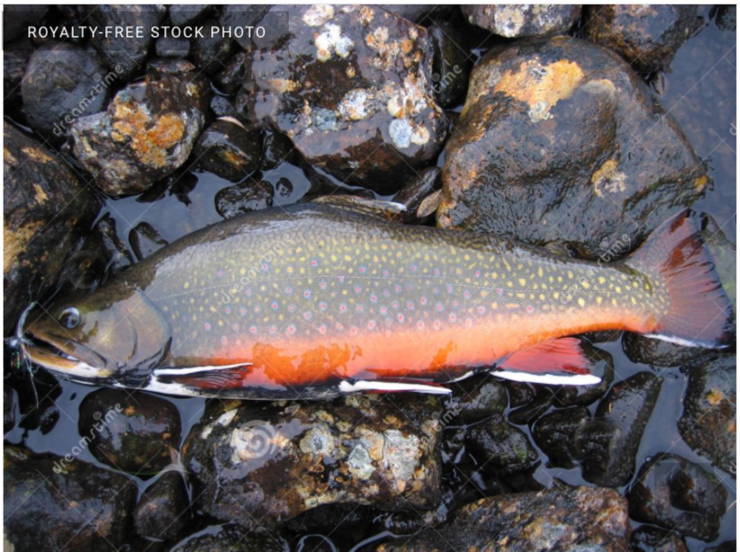
Dams present a physical barrier to aquatic creatures moving up and downstream. Perhaps no other animal illustrates this movement better than the native brook trout. The Ompompanoosuc River above the Union Village Dam is a designated fishery in Vermont and an Eastern Brook Trout Protection watershed. These are perhaps our most beautiful freshwater fish. They thrive in the coldest and cleanest water. Freedom to migrate, for spawning or to seek water of the right temperature, is very important. If the water becomes too warm, they will migrate to find cooler temperatures, typically in deep river pockets or tributaries that are shaded. With adequate habitat diversity, some may not move very far. However, other populations migrate over long distances, 75 miles or more, in search of thermal refuge or spawning habitat. Gravel is critically important to brook trout spawning. The eggs are fertilized by the male as the female releases them and sink into nooks and crannies in the gravel. After hatching, the tiny larvae seek protection in pockets between rocks. Siltation caused by dams fills these spaces and prevents brook trout reproduction.
Downstream of a dam there are consequences, too. The river is fed overly warm water from the pool. It is also “starved of silt” and nutrients and erodes its banks and the river bed to an abnormal extent.
These impacts and the dam's disused condition were recognized in the Tactical Basin Plan for (River) Basin 14, drawn up by the Vermont Department of Environmental Conservation (DEC), which addresses river health, areas of concern, and strategies for improvement. Similarly, the 2011 Survey of the Ompompanoosuc commissioned by the Thetford Conservation Commission identified the Montague Dam as a high priority for removal and river channel restoration.
The DEC works in partnership with the Connecticut River Conservancy (CRC), an organization that strives to reduce human impacts on the Connecticut River and tributaries to improve fish passage and flood resiliency. Ron Rhodes of the CRC was awarded a grant to pay for the removal of the Montague dam and restoration of the river channel.
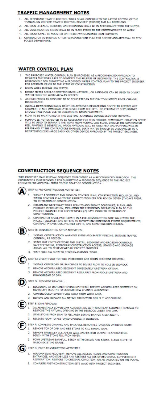
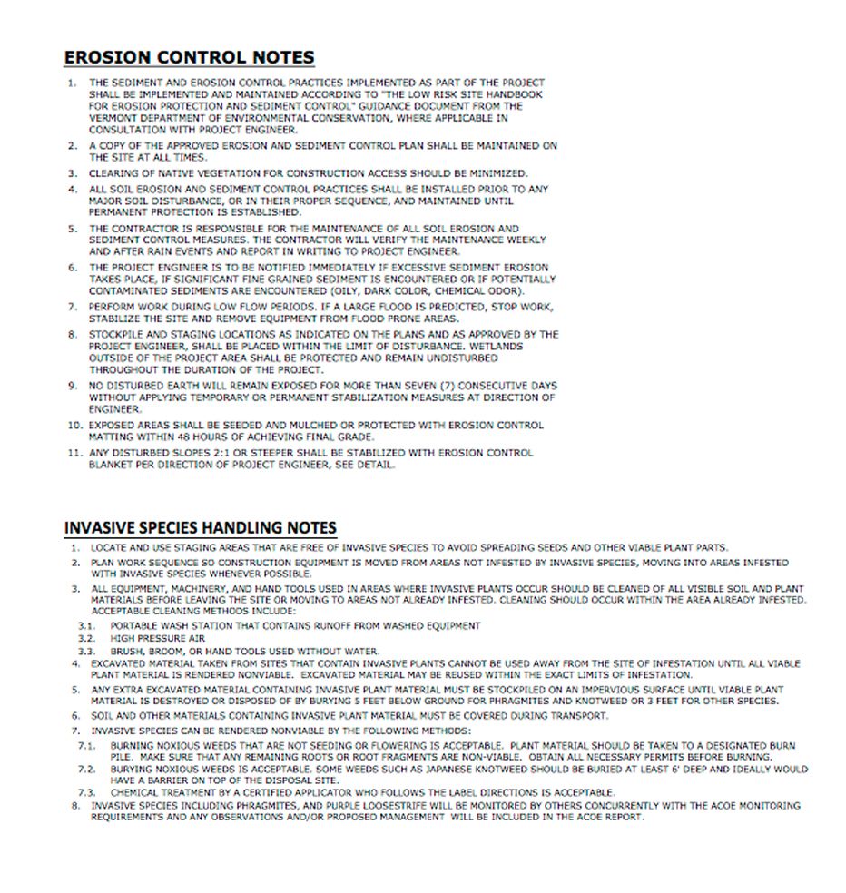
Ron Rhodes supplied engineering drawings of the project and welcomes questions from the public: 413-772-2020 Ext: 214
An instructive engineering drawing is depicted here, (though it may be too small to be legible.)
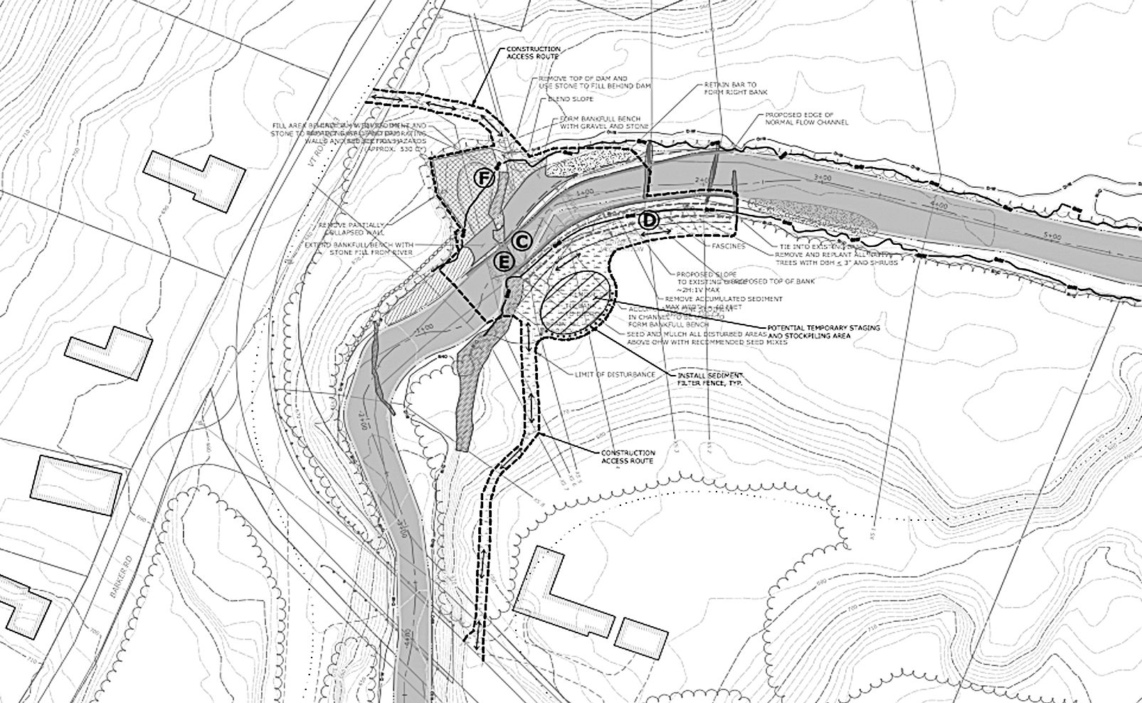
Multiple parties are involved in this project. The plan has the support of dam owner Walter Malmquist, who also owns the now-demolished mill. The abutting neighbors approve as well. Also consulted were the Vermont Division for Historic Preservation and experts in Cultural Resources who review any “project, activity, or program… that can result in a change in the character or use of an historic property or historic resource.” The dam was inspected by the DEC, the US Fish and Wildlife Services, and other agencies. The parties agreed that a portion of the stone structure would be retained. The concrete portion of the dam and the sediment will be removed. Fall hazards will be reduced. Enough of the river channel will be restored to allow fish passage and reduce risks of flooding and erosion damage to nearby properties.
The area around the dam is overgrown with mostly invasive, non-native plants. The plan avoids the spreading of these plants.
The funding itself comes from the Upper Connecticut River Mitigation and Enhancement Fund. This was established in 1997 as part of the settlement agreement in the federal process to award an operating license to three hydroelectric dams (Comerford, McIndoes, and Moore) on the Connecticut River at the Fifteen Mile Falls that have changed the face of the river. The Project Owner pays 10% of the dams’ gross revenues, or $100,000, whichever is the greater amount, into the fund every year. The purpose is to “mitigate” the effects of these dams on the watershed by supporting “restoration, protection and enhancement of the river, wetlands, and shorelands within the Connecticut River watershed upstream of the confluence of the White River and the Connecticut River.”
Ron Rhodes said that the schedule for the project is not yet fixed. It could possibly start this year, but could also be postponed till 2022.