
A spotlight on culverts
Only 51 culverts in Thetford were rated as “Poor."
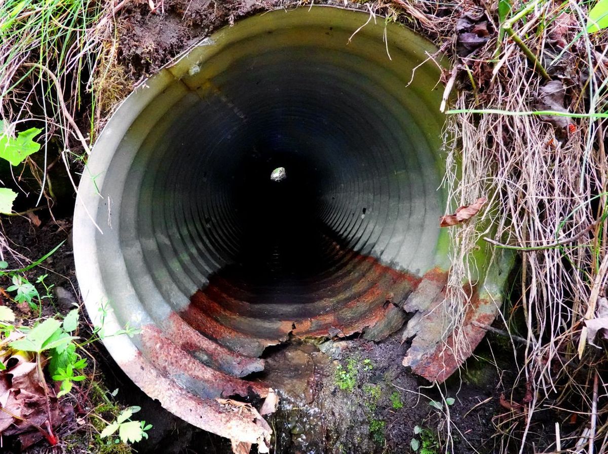
Culverts are among those prosaic items that seem as dull as the ditchwater that flows through them. They enter our consciousness rarely, if ever, and when they do it is usually bad news.
However, our transportation network of roads wouldn’t be drivable for long without culverts and the ditches that feed them. Thetford is a landscape of hills and valleys that receive on average 39.4 inches of rain a year (about an inch above the national average). All that water runs off the landscape into rivers and streams. These watercourses have carved valleys that have habitually served as easy access routes for trails, paths, and, eventually, roads.
A road in a valley must withstand rain runoff coming down the valley and also from the hillside on the upslope side, the side away from the stream. Roadside ditches divert the runoff from washing away the road. But water in the upslope ditch has to cross the road before the ditch fills to capacity and overflows. Culverts simply allow ditchwater to flow safely under a road so it drains away on the downslope side.
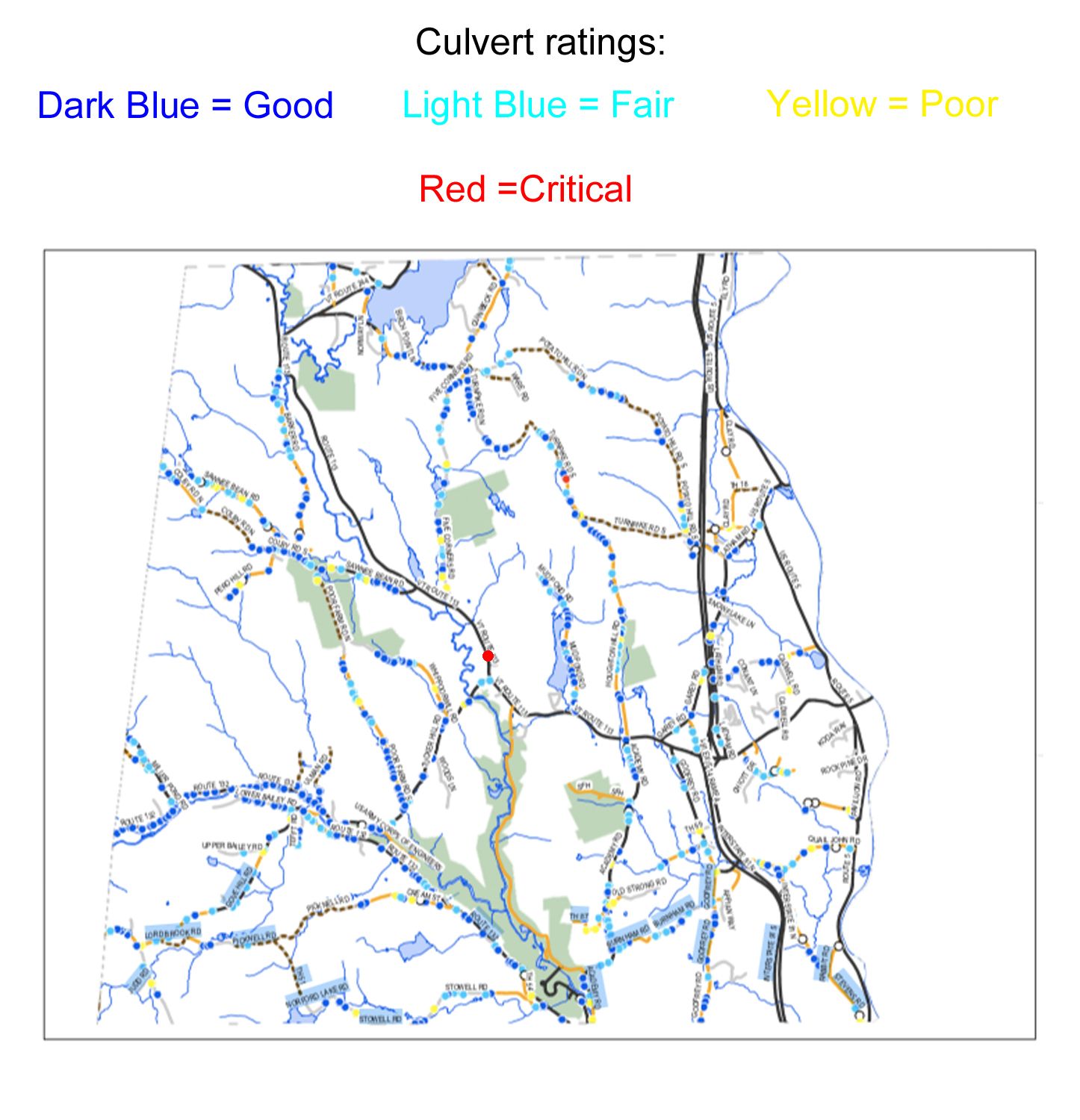
Culverts are ubiquitous and they can be costly. A total of 570 culverts cross under roads in Thetford, as counted in the 2021 Thetford Culvert Inventory completed by TRORC (Two Rivers-Ottauquechee Regional Planning Commission). About thirty of those culverts are on the section of Route 132 between Strafford and Tucker Hill Road, and about half of them required replacement during the rebuilding of that road section to the tune of thousands and thousands of dollars. Individual culverts also exact a price. For instance, in April of 2020 a concrete “box” culvert under Route 132, south of Tucker Hill, was found to have a partially collapsed sidewall. In addition, erosion beneath the culvert floor had hollowed out a cavity “big enough to crawl into.” A cave-in of half of the road was in the making. Stabilizing and repairing this culvert without its complete replacement cost $146,000.
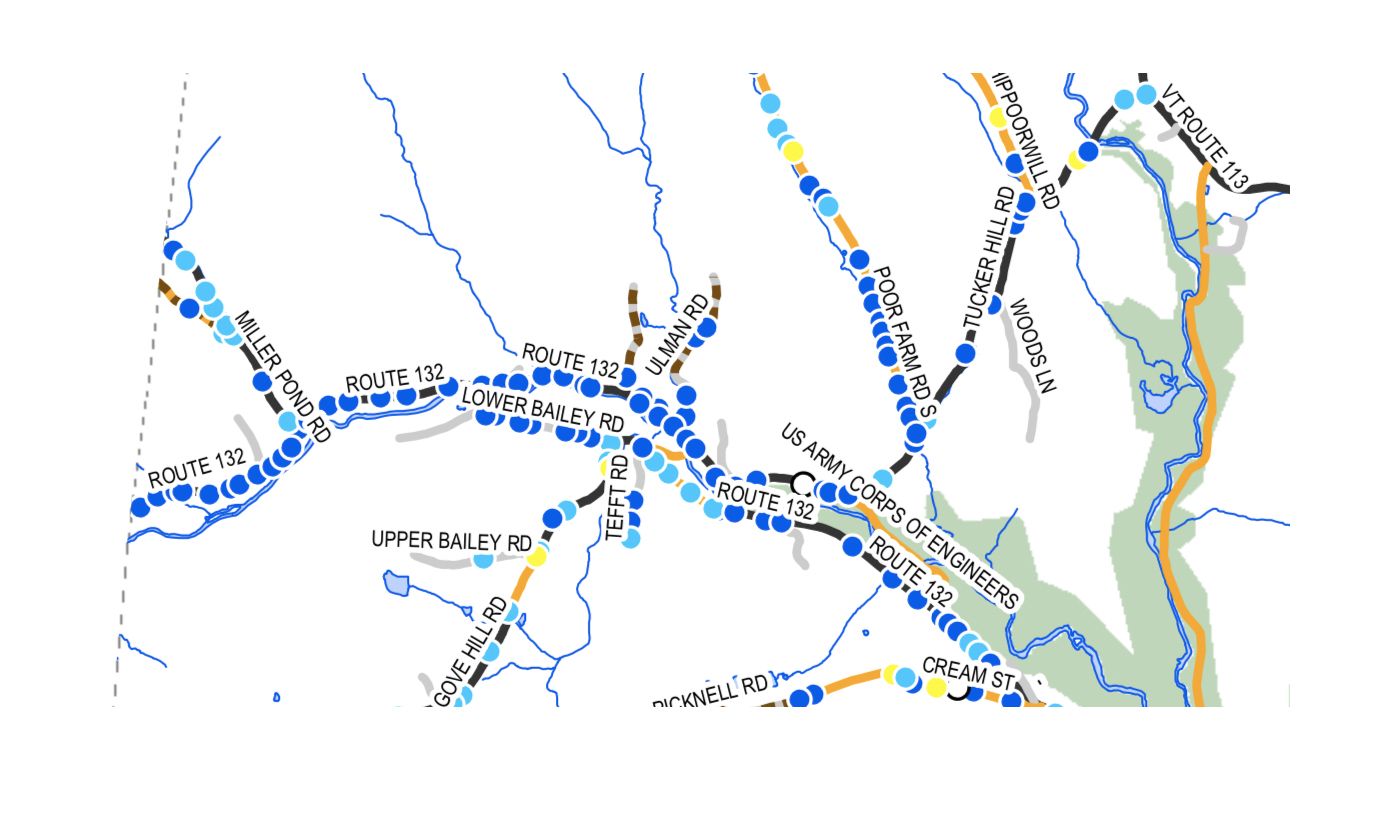
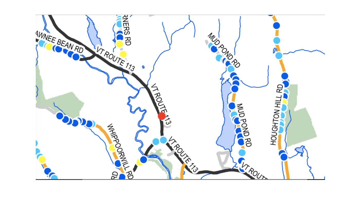
Thetford is perhaps fortunate in that only 51 out of its 570 culverts were rated in “Poor” condition by the TRORC survey (yellow circles on map). One hundred and seventy-four culverts were rated as “Fair” (light blue circles) and 391 as “Good” (dark blue circles). Two culverts were in “Critical” condition (red circles). One is on Route 113, the first culvert north of the Tucker Hill Rd junction. This is a state road, so presumably VTrans is responsible for it and not the Town. The other one is on the Class 4 section of Turnpike Road North.
Culvert condition may be classified as poor for a number of reasons. Some suffer from incorrect installation. A culvert may be susceptible to crushing if the material around it is insufficiently compacted. The absence or loss of the stone headwall and end wall at either end of a culvert invites erosion around the culvert. Eventually water bypasses the culvert altogether and undermines the road. Culvert ends without stone protection also tend to get crushed. Metal culverts age and eventually rust, which often goes undetected till the culvert collapses. (Double-walled plastic is now the material of choice for many culverts.) One of the biggest impairments of culvert function is blockage by road sand and gravel and fallen leaves accumulated in ditches.
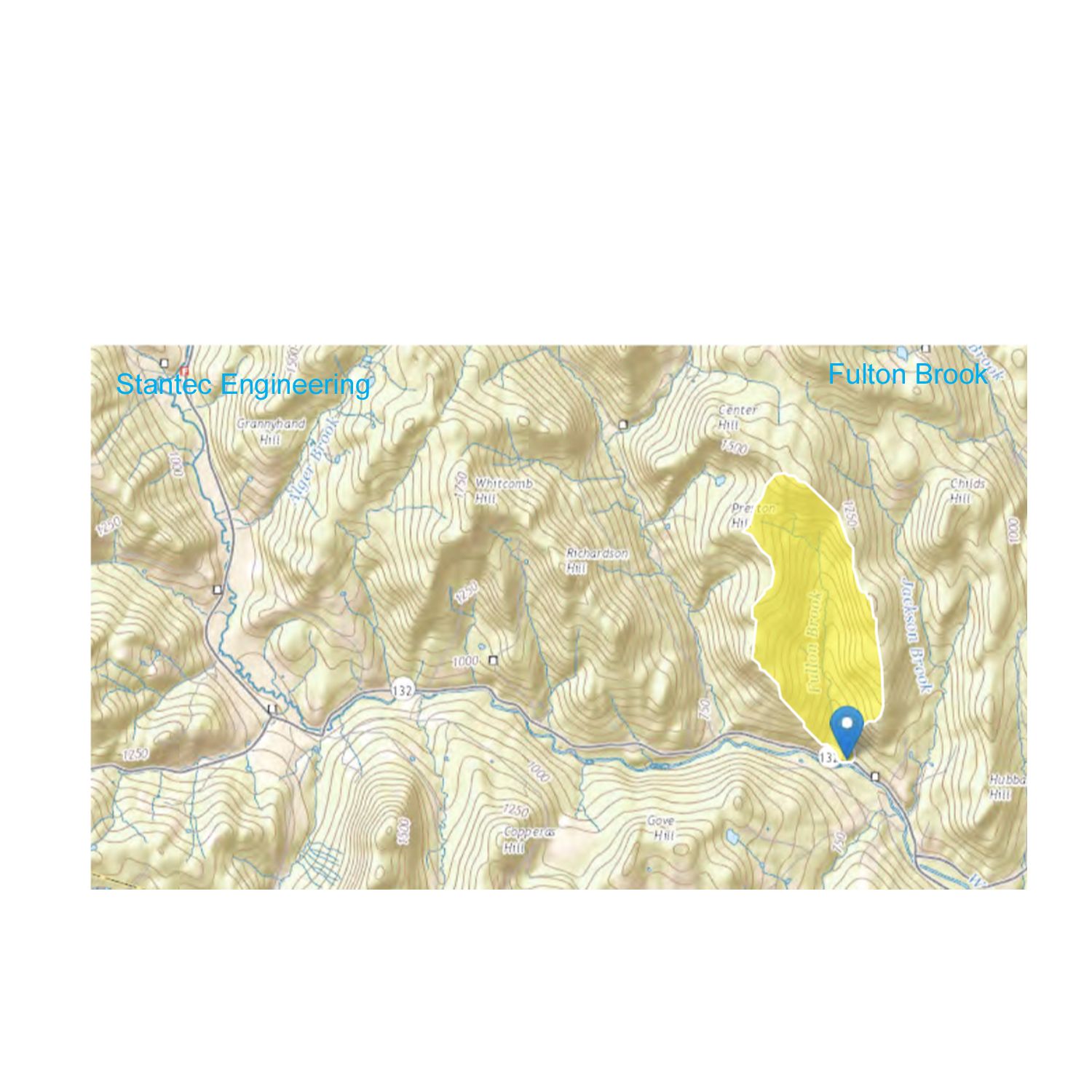
Some culverts are just too small to handle major storm runoff. This problem is exacerbated as climate change produces bigger storms that tend to stall rather than move through, dousing us with prolonged periods of rain. The State of Vermont warns "Since so many Vermonters live in valleys along rivers, and since we expect storms to become more intense in coming decades, our vulnerabilities to flooding and erosion may increase." When culverts cannot handle the volume of water, road washouts result, as starkly illustrated by the storm of July 1, 2017. Many residents were left stranded and cut off from essential services when roads became washed-out ravines. Engineering studies are now used to help with the sizing of critical culverts. In repairs of Route 132, the engineering firm Stantec used GIS data to map the watersheds of streams that cross under the road, such as Fulton Brook. From the map area they calculated how much stormwater might fill the stream in a 2-year peak flood all the way to a 500-year peak flood in order to size the stream culvert appropriately. If a culvert looks much too big in a dry spell, it’s probably a good thing.
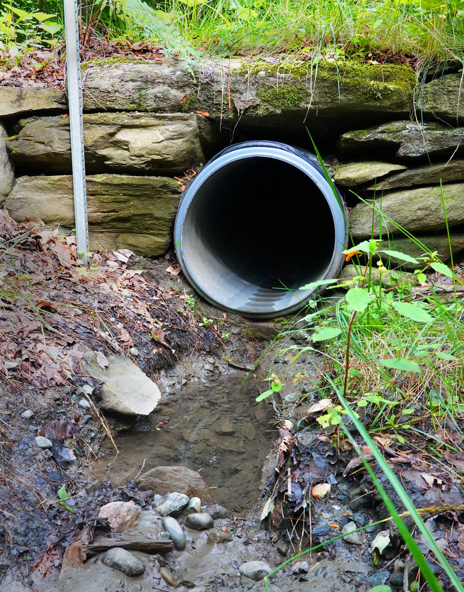
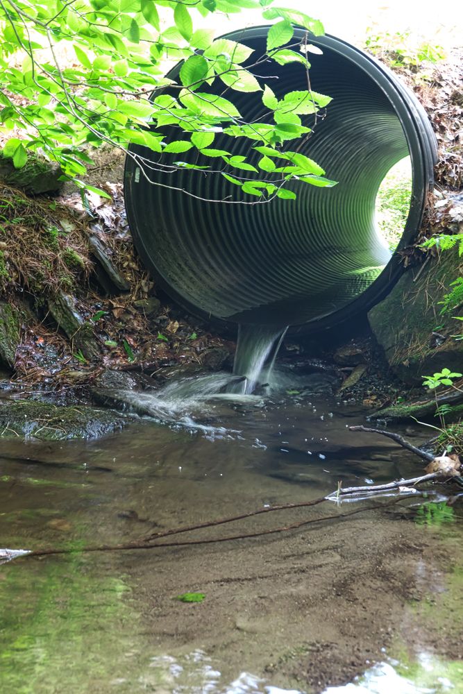
Streams are home to all sorts of life forms and when a stream is channeled under a road in a culvert it can result in problems. A frequent issue is that the culvert is too high on the downstream side - a so-called hanging culvert. Water pours from the hanging end in a waterfall that fish cannot swim up to travel upstream. Nor can many fish jump the gap. The waterfall often hits the stream bed forcefully and erodes it, scouring out a hole. When correctly installed a stream culvert has both ends level with the stream bed. Better still is designed with a flat bottom covered with gravel. Such culverts frequently serve as road crossings for all manner of wildlife and reduce the uneccessary slaughter of road kill.
Culverts are an unnoticed but very important part of the Town’s infrastructure. With proper installation and periodic cleaning they can serve for decades. Perhaps we can all pay our nearest culverts a long overdue visit and inform the Town Manger or DPW if we find blockages or other problems.
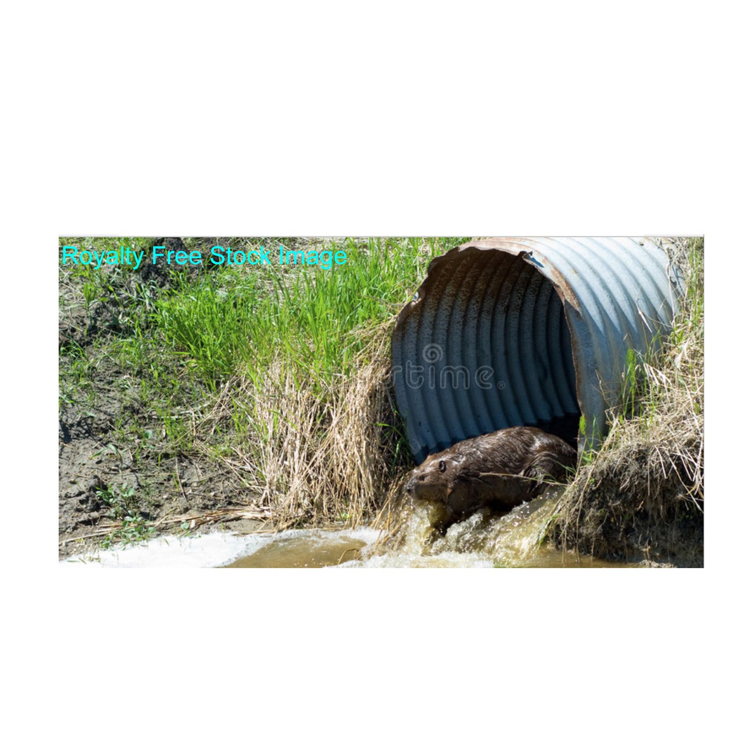
Photo credit: Li Shen except where otherwise indicated