
Can they get there from here? Land Trust explores regional wildlife connectivity
The lack of information about wildlife movement through our broken-up landscape inspired the Upper Valley Land Trust that oversees conserved properties to launch a study on the topic
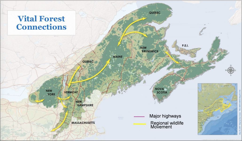
In the Upper Valley we enjoy a wide variety of landforms that are interspersed with water features such as the Connecticut River, wetlands, lakes, and ponds. The region’s forests are part of the largest remaining temperate broadleaf forest in the world (extending between MA, ME, NH, VT, NY and parts of Canada). Fields and orchards remind us of the long tradition of farming here. We are fortunate that many landowners appreciate that these places support a diversity of wildlife as well as scenic vistas and have conserved their properties, often through the Upper Valley Land Trust.
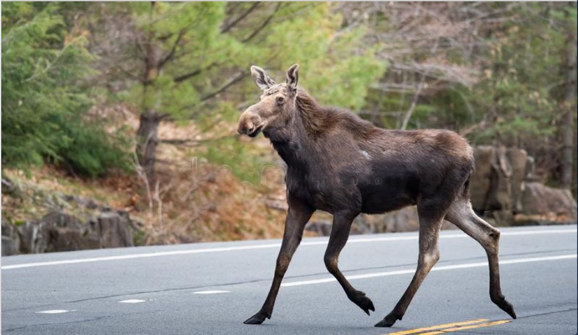
Animals roam far more widely than many people appreciate. That’s because their food and other resources come and go in different locations according to season. For instance, moose feed on rich wetland vegetation in valley lowlands in summer, but relocate to high-elevation conifer forest in the winter. As a result, the home range of a moose can vary from five to fifty square miles, depending on habitat quality. Even small animals can surprise us. A flock of wild turkeys requires from one to four square miles. A female bobcat’s territory may cover six square miles, according to the National Trappers Association, and a male up to sixty square miles.
Whether our region’s conserved lands provide a benefit to wildlife depends on the land remaining accessible to animals. The region is transected by two interstate highways, railway lines, and numerous state and town roads. Human settlement has spread outside of traditional village centers to occupy formerly open spaces in fields and forest. These man-made features are obstacles that deter the free movement of wildlife. Animals generally avoid people and prefer to travel under cover of trees and vegetation. The wide-open space of a road is intimidating, and those that dare to cross can and do get killed by vehicles.
The lack of information about wildlife movement through our broken-up landscape inspired the Upper Valley Land Trust that oversees conserved properties to launch a study on the topic. This Wildlife Connectivity Study relies on real, on-the-ground data, rather than what can be gleaned remotely from aerial photos and maps. Due to practical considerations like logistics and budget, the study focuses on a portion of the UVLT service area in Thetford, West Fairlee, Fairlee, Norwich, Bradford, Piermont, Orford, Lyme, and out to Enfield.
Conserved properties that might be a safe route for animals to reach the Connecticut River were of particular interest. The river is both a north-south travel corridor and a barrier for movement between VT and NH, though one potential river crossing may exist in the north part of Thetford. Landowners were approached, and there was overwhelming support for volunteers to walk their property to look for animal tracks and signs. Twenty-nine properties, nine of which are in Thetford, are in the study. The volunteers in question, five from Thetford and ten in all, have all received training in track and sign identification from Sue Morse, the well-known wildlife biologist, author, and contributor to Northern Woodlands magazine. Sue is dedicated to training anyone, from VTrans employees to tracking teams in many towns, and is founder of the Keeping Track organization.
In addition to data from volunteers, biologist/ecologist Jesse Mohr is working to verify predicted road crossings on roads — for instance those cutting through otherwise intact forests. He will also determine which culverts afford animals a sheltered crossing. He is deploying game cameras at these sites. Jesse is also documenting the road crossing sites used by amphibians in their spring migrations to their breeding areas.
This study will shed light on how roads and other infrastructure in our region constrain the movement of wildlife in search of seasonal resources. These man-made features also impact the dispersal of young animals that have left their mothers and are seeking to establish their own territory.
Wildlife species also need travel corridors to relocate in response to climate change. On a continent-wide scale, scientists surmise that only forty-one percent of the natural land area in the whole United States retains enough connectivity to allow species to track their preferred climate conditions as the global climate changes. That percent is likely much smaller in our fragmented region. This study will provide a sample of on-the-ground, local knowledge to the big picture.
Like all UVLT ventures, this study relies on the generosity of residents who may contribute their support to the Wildlife Connectivity Study.