
A Guide to the Thetford Capacity for Growth Study
To be clear, the Capacity For Growth Study is not a mandate to develop or a prescription for what people should do with their land.
The long-awaited Capacity for Growth Study has been released – all 115 pages of it. That is a hefty amount of reading for the average town resident even though a lot of the pages are taken up with maps. Here’s the short version.
The document may be downloaded from the Town website at https://www.thetfordvt.gov/government/capacity-study-steering-committee. Looking at the maps and tables as you read this might be helpful.
The study was conducted by the engineering company Dubois and King with assistance and input from the Capacity Study Steering Committee of volunteers. Its goal was to recommend areas in Thetford where more housing could be built that would be close to village amenities and transportation. This is in line with the State's desired pattern of growth, which seeks to maintain the traditional pattern of discrete towns and villages set within sparsely developed rural countryside – in other words, the quintessential Vermont that attracted many to come here in the first place.
The consultants were careful to point out in the Executive Summary preceding Chapter 1 that the study is not a mandate to build. It only intends to offer motivation to owners of properties close to centers of development to initiate new housing. This is much preferable to scattershot development springing up in formerly intact forest blocks or impinging on sensitive natural features such as wetlands.
Chapter 1 summarizes the need for planning and outlines some guiding principles. It also lists Town resources that provided the consultants with valuable information about Thetford, including the 2020 Town Plan, the 2021 Phase 1 Natural Resource Inventory, the 2024 Zoning bylaw, the 2021 Subdivision Regulations, The Flood Hazard Bylaw, the 2023 Community Water Systems Report, the State-Designated Village Centers, and the Fluvial Erosion Hazard Map.
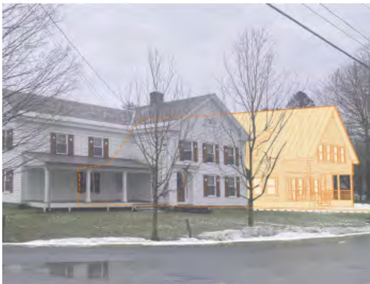
Chapter 2 evaluates Thetford's five villages with detailed maps of East Thetford, Thetford Hill, Thetford Center, Post Mills, and North Thetford. The three hamlets of Union Village, Rices Mills, and Campbell Corner were also mapped, but were not further considered. All these maps are on pages 6-21. The five villages were evaluated for features that favor housing growth, such as community resources and transportation versus features that work against growth, such as flood risk, steep slopes, forest blocks, etc. These assessments are summarized in table form on pages 24-27.
The conclusion of this evaluation is given on page 28. The villages were considered first as nuclei around which housing growth could extend. Two villages, Post Mills and East Thetford, were most obviously conducive to growth. Thetford Hill was also considered, but it has enough environmental constraints that, after feedback from the community and the Steering Committee, an area adjacent to Thetford Hill, between villages, emerged as a more promising location.
Post Mills was chosen because it offers agricultural employment opportunities, recreation at nearby Lake Fairlee, a library, a church, and a preschool.
East Thetford was chosen because there is possible employment at existing retail and service businesses within walking or biking distance of potential new housing. There are few environmental constraints, and it is zoned as Thetford's only Town Community Business District.
The third area is adjacent to Thetford Hill Village and extends down to Route 5 just south of East Thetford Village. It is referred to in the study as Academy South and was chosen after lengthy consideration by the Study Committee as well as the consultants. This area is close to Thetford's schools and contains historic, cultural, and recreational resources. It is notable that Thetford Hill is the only village in Thetford that is outside of any FEMA flood zone.
Chapters 3 and 4 offer an analysis of existing wastewater capacity, summarized in the table on Page 31, and a traffic analysis showing traffic patterns and high crash locations in the three chosen areas. These are mapped on Pages 32 and 33.
The meat of the study comes in the next few chapters, beginning with Chapter 5. These pages consist of seven maps for each location, plus a narrative for each map.
For each chosen location, a Study Area was established through a collaborative process between the consultants and the Study Committee. Together they analysed maps, looking for land parcels in and around that location that were most likely to offer capacity for housing growth. This included land outside of traditional village boundaries. All these land parcels were consolidated within the boundary of the Study Area for each location.
Each Study Area was then mapped for criteria that had been decided by the committee and the public as part of the Request For Proposals. The RFP led to the selection of Dubois and King as the consultants for this study. The criteria were: Thetford Zoning districts, environmental constraints (2 maps), soils, subdivision potential, and something called Base Lot Calculations.
Maps of the Post Mills Study Area are on pages 40-53.
Maps of the East Thetford Study Area are on pages 55-57.
Maps of the Academy South Study Area are on pages 69-81.
Environmental constraints like steep slopes, wetlands, river corridors, wildlife connectivity forest areas, and surface water riparian areas were mapped so that parcels that were not appropriate for housing development could be removed from further consideration. Likewise, housing buildout should avoid productive agricultural soils.
Parcels that were minimally encumbered by environmental constraints were examined for their potential for subdivision based on their size and Zoning District.
In the Post Mills Study Area, 174 parcels were evaluated.(Map page 51). Of these, 76 parcels do not support further subdivision (82 is a mistake in the figure legend), while 46 parcels could be further subdivided (44 is a mistake in the figure legend).
In the East Thetford Study Area (Map p. 65), 39 parcels could not be further subdivided (82 is a mistake in the figure legend), while 34 parcels had subdivision potential (44 is a mistake in the figure legend).
In the Academy South Study Area (Map page 79), 21 parcels could not be further subdivided, and 5 parcels could support further subdivision.
In all three Study Areas, subdivision "may be possible" on the rest of the parcels.
The consultants then performed a Base Lot Calculation for each Study Area. This computed the maximum number of house lots that could be obtained if each parcel were subdivided to the fullest extent allowable under the Thetford Zoning Bylaw. If a parcel spanned more than one Zoning District, the number of potential new lots was calculated by summing the number of lots allowed under the rules for each district.
Base Lot Calculation Maps may be found on the following pages: Post Mills, page 53; East Thetford, page 67; Academy South, page 81.
This exercise resulted in what looks like a large number of potential new housing lots. However, not all lots are equally easy or desirable to develop.
Thus the potentially subdividable parcels were cross-compared for a number of different criteria (attributes) by a method called Focus Level Ranking. All subdivideable parcels were ranked into A, B, or C Focus Level groups.
Focus Level A parcels have the greatest realistic subdivision potential, and the study recommends they be considered first. They are "generally larger lots with more buildable area and fewer environmental encumbrances." Few have existing buildings. A larger lot size allows an economy of scale that encourages the construction of a higher number of housing units. This, in turn, produces a greater financial return relative to the costs of design, mobilization, materials, labor, and marketing. In addition, a large lot provides more opportunity to develop on-site sources of drinking water and wastewater disposal infrastructure. Parcels within walking or biking distance to village amenities were also more likely to be in the A rank.
Focus Level B parcels were generally mid-sized lots that have an existing house and somewhat greater environmental encumbrances.
Focus Level C parcels tended to be smaller, though not always. Some have been recently redeveloped or have existing buildings occupying part of their area. They also have a greater degree of environmental encumbrance and are situated at a distance from village amenities.
Focus Level Maps are accompanied by Tables of Attributes showing the reasons for the rankings, as follows:
Post Mills, Map page 85; Tables of Attributes, pages 86-89
East Thetford, Map page 91; Tables of Attributes, pages 92-97
Academy South, Map page 99; Tables of Attributes, pages 100-101.
The Tables of Attributes conclude the major part of the document that deals with actual land parcels in Thetford.
Chapter 7 describes Design Concepts, starting with the need to avoid rural sprawl. It goes on to introduce the "Enabling Better Places Guide" that addresses topics with the most impact on housing affordability in Vermont. The chapter also provides examples of different types of housing and how they might be laid out on a conceptual 5-acre parcel.
Chapter 8, the final chapter, is an overview of next steps, including thoughts on community water and wastewater, and recommendations for changes to Thetford's Zoning Bylaw to streamline the process of getting a building permit.
To be clear, the Capacity For Growth Study is not a mandate to develop or a prescription for what people should do with their land. Nor does it preclude home building in other parts of Thetford. The Study is meant as a tool that interested property owners may use at their own discretion.
A printed copy of the study may be requested at Town Hall. However, due to the large number of pages and colored maps, there will be a charge for this.